Datei:Little Great and white Russias 1747 Bowen map.jpg
Originaldatei (1.328 × 1.296 Pixel, Dateigröße: 440 KB, MIME-Typ: image/jpeg)
| Beschreibung |
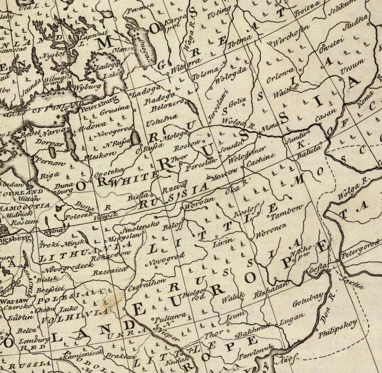
English: Great, Little and White Russias in 1747 |
||||
| Datum | |||||
| Quelle | https://en.wikipedia.org/wiki/File:Little_Great_and_white_Russias_1747_Bowen_map.jpg | ||||
| Urheber | Bowen, Emanuel | ||||
| Genehmigung (Weiternutzung dieser Datei) |
|
||||
Beschreibung
A fragment of the old map.
Original full title of the map: A new and accurate map of Europe. Collected from the best authorities, assisted by the most approv'd modern maps & charts. The whole being regulated & adjusted by astronl. observations, by Emanl. Bowen. (London: Printed for William Innys, Richard Ware, Aaron Ward, J. and P. Knapton, John Clarke, T. Longman and T. Shewell, Thomas Osborne, Henry Whitridge ... M.DCC.XLVII)
Author: Bowen, Emanuel
Date: 1747
Publisher: London: William Innys [et al.]
Scale 1: 13,000,000
Pub Date: 1747
Pub Title: A complete system of geography. Being a description of all the countries, islands, cities, chief towns, harbours, lakes, and rivers, mountains, mines, &c. of the known world ... In two volumes. The whole illustrated with seventy maps, by Emanuel Bowen, Geographer to His Majesty, being all new-drawn and ingraved according to the latest discoveries and surveys; making, of themselves, a complete atlas, for the sse of gentlemen, merchants, mariners, and others, who delight in history and geography ... Vol. 1. London: Printed for William Innys, Richard Ware, Aaron Ward, J. and P. Knapton, John Clarke, T. Longman and T. Shewell, Thomas Osborne, Henry Whitridge ... M.DCC.XLVII.
File cropped from the source obtained at David Rumsey Map Collection (http://www.davidrumsey.com/detail?id=1-1-2552-270004&name=Map+of+Europe.)
Dateiversionen
Klicke auf einen Zeitpunkt, um diese Version zu laden.
| Version vom | Vorschaubild | Maße | Benutzer | Kommentar | |
|---|---|---|---|---|---|
| aktuell | 23:58, 7. Jul. 2014 | | 1.328 × 1.296 (440 KB) | wikimediacommons>Wwbread | {{Information |Description ={{en|1= A fragment of the old map. Original full title of the map: A new and accurate map of Europe. Collected from the best authorities, assisted by the most approv'd modern maps & charts. The whole being regulate... |
Dateiverwendung
Die folgende Datei ist ein Duplikat dieser Datei (weitere Details):
- Datei:Little Great and white Russias 1747 Bowen map.jpg aus einem gemeinsam genutzten Medienarchiv
Die folgende Seite verwendet diese Datei: