Datei:USGS 1950s mapping field camp.jpg

Größe dieser Vorschau: 800 × 497 Pixel. Weitere Auflösungen: 320 × 199 Pixel | 640 × 398 Pixel | 1.024 × 637 Pixel | 1.280 × 796 Pixel | 2.672 × 1.661 Pixel.
Originaldatei (2.672 × 1.661 Pixel, Dateigröße: 3,5 MB, MIME-Typ: image/jpeg)
Beschreibung
| Beschreibung |
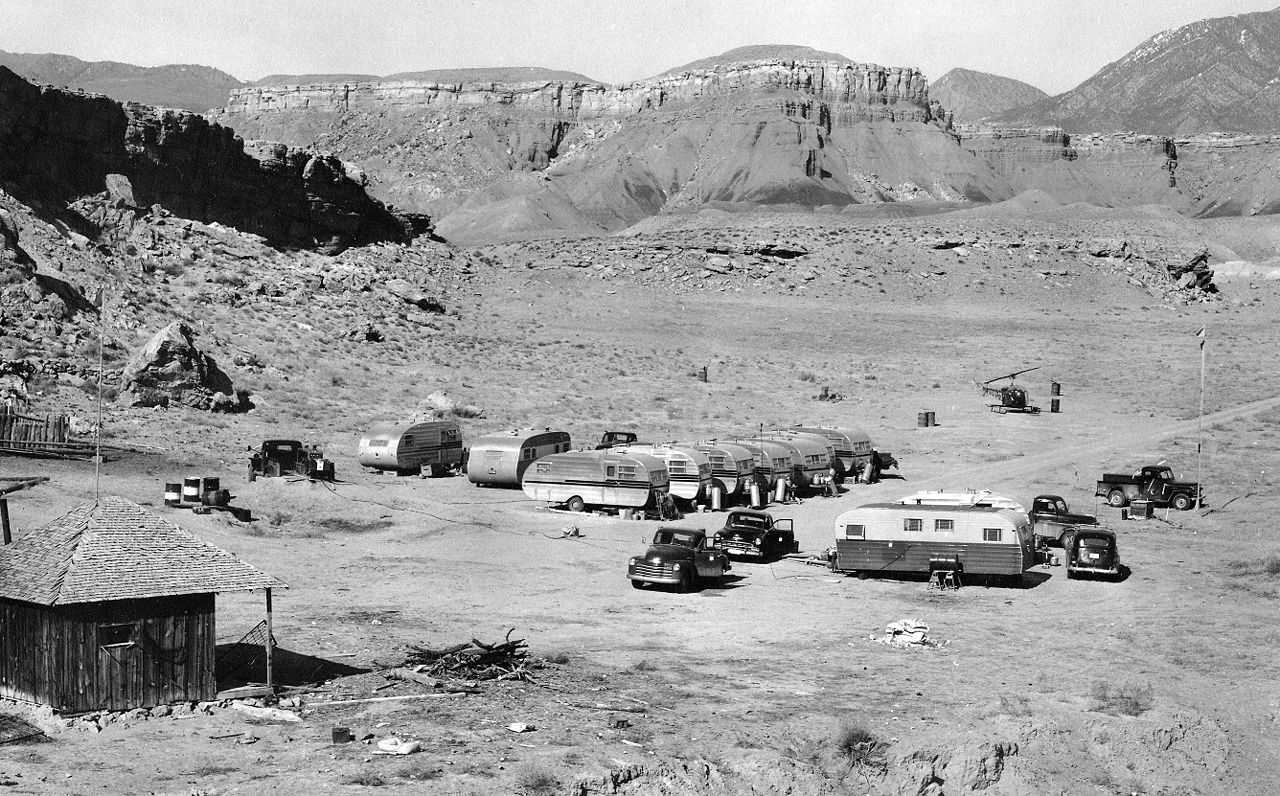
English: A typical USGS mapping field camp. Note the helicopter parked near the trailers. Helicopters were first used by the USGS for topographic mapping in Death Valley in 1948. (Description from USGS.) |
| Datum | etwa 1950 bis 1955 |
| Quelle | USGS Historical Photographs: Mapping Field Camp: http://online.wr.usgs.gov/outreach/historicPhotos/enlarged/mapping_camp_1950.html |
| Urheber | US Geological Survey |
Lizenz
Dieses Bild ist gemeinfrei (public domain), weil es Materialien beeinhaltet, die ursprünglich vom United States Geological Survey, einer Behörde des Innenministeriums der Vereinigten Staaten, stammen. Weitere Informationen finden Sie in den Urheberrechtsbestimmungen des USGS
|
Dateiversionen
Klicke auf einen Zeitpunkt, um diese Version zu laden.
| Version vom | Vorschaubild | Maße | Benutzer | Kommentar | |
|---|---|---|---|---|---|
| aktuell | 22:50, 30. Jan. 2009 | | 2.672 × 1.661 (3,5 MB) | wikimediacommons>Awickert | {{Information |Description={{en|1=A typical USGS mapping field camp. Note the helicopter parked near the trailers. Helicopters were first used by the USGS for topographic mapping in Death Valley in 1948. (Description from USGS.)}} |Source=USGS Historical |
Dateiverwendung
Die folgende Seite verwendet diese Datei: