Datei:Shetland UK parish map (blank).svg

Größe der PNG-Vorschau dieser SVG-Datei: 315 × 599 Pixel. Weitere Auflösungen: 126 × 240 Pixel | 252 × 480 Pixel | 404 × 768 Pixel | 538 × 1.024 Pixel | 1.077 × 2.048 Pixel | 832 × 1.582 Pixel.
Originaldatei (SVG-Datei, Basisgröße: 832 × 1.582 Pixel, Dateigröße: 1,54 MB)
.svg)
| Beschreibung |
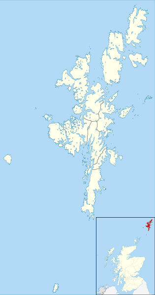
Blank map of the Shetland Islands, UK with parishes shown. Equirectangular map projection on WGS 84 datum, with N/S stretched 200% Geographic limits:
|
| Datum | |
| Quelle |
General Register Office for Scotland Ordnance Survey OpenData. Most data from Boundary-Line product. Lake data from Meridian 2 product. Inset derived from File:Scotland location map.svg by NordNordWest. |
| Urheber | Nilfanion, created using Ordnance Survey data |
| Genehmigung (Weiternutzung dieser Datei) |
Diese Datei ist unter der Creative-Commons-Lizenz „Namensnennung – Weitergabe unter gleichen Bedingungen 3.0 nicht portiert“ lizenziert. Namensnennung: Contains Ordnance Survey data © Crown copyright and database right 2013 Contains NRS data © Crown copyright and database right 2013
|
Dateiversionen
Klicke auf einen Zeitpunkt, um diese Version zu laden.
| Version vom | Vorschaubild | Maße | Benutzer | Kommentar | |
|---|---|---|---|---|---|
| aktuell | 01:11, 10. Nov. 2013 | | 832 × 1.582 (1,54 MB) | wikimediacommons>Nilfanion | {{Information |Description=Blank map of the Shetland Islands, UK with parishes shown. Equirectangular map projection on WGS 84 datum, with N/S stretched 200% Geographic limits: *West: 2.15W *East: 0.70W *North: 60.88N *South: 5... |
Dateiverwendung
Die folgende Seite verwendet diese Datei:
.svg)