Datei:Mobile Alabama harbor aerial view.jpg
Größe dieser Vorschau: 800 × 533 Pixel. Weitere Auflösungen: 320 × 213 Pixel | 640 × 426 Pixel | 1.024 × 682 Pixel | 1.500 × 999 Pixel.
Originaldatei (1.500 × 999 Pixel, Dateigröße: 664 KB, MIME-Typ: image/jpeg)
| Beschreibung |
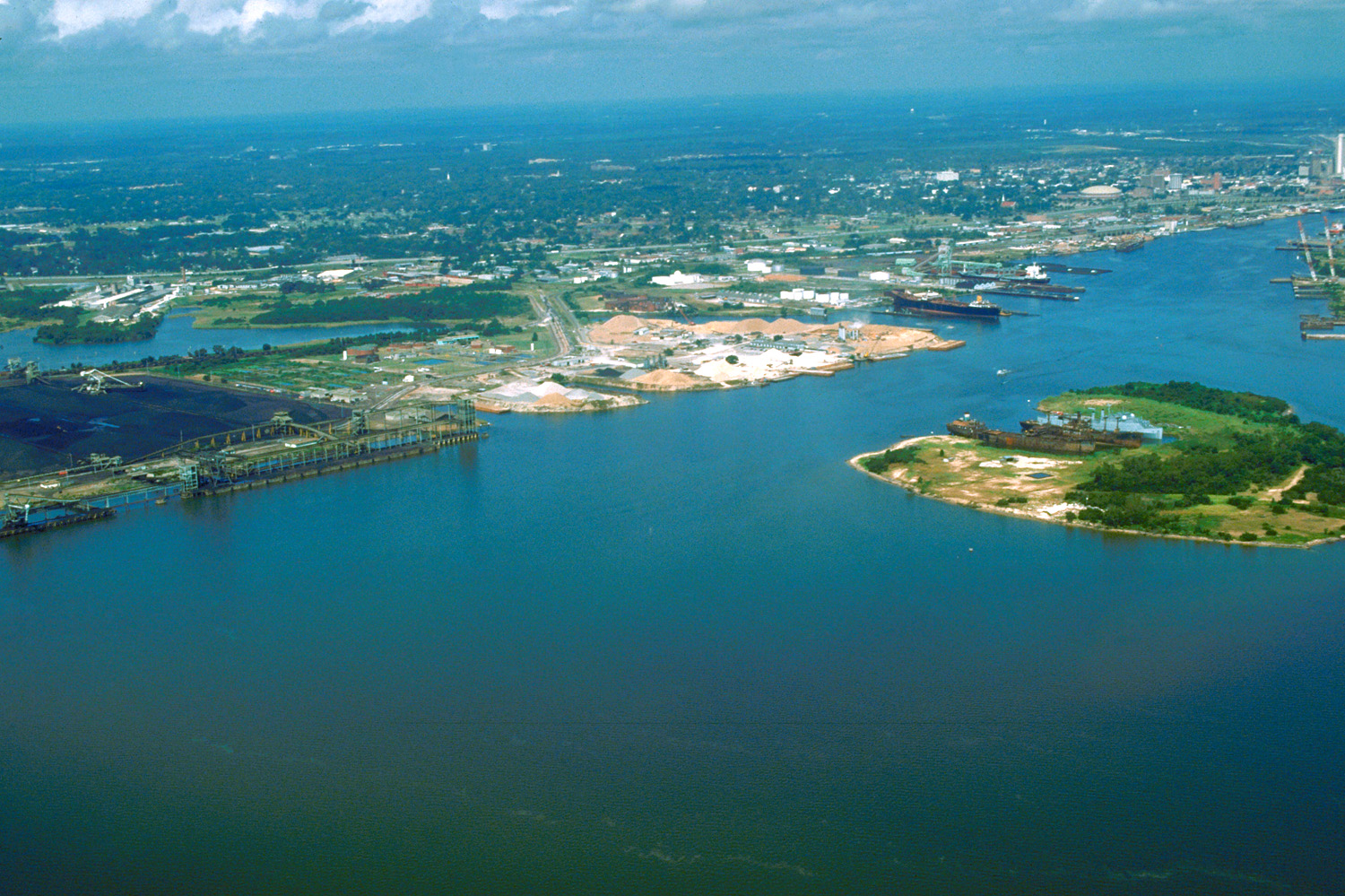
English: Aerial view of the port and city of Mobile, Alabama, USA. The view is from the harbor on Mobile Bay to the northwest over the central area of the city. |
|||
| Ort | Mobile, Alabama, USA 30°39′47.39″N 88°1′59.79″W / 30.6631639°N 88.033275°W |
|||
| Datum | (Caution: Dates provided by U.S. Army Corps of Engineers web pages are not reliable and are often wrong.) | |||
| Quelle |
U.S. Army Corps of Engineers Digital Visual Library Image page Image description page Digital Visual Library home page |
|||
| Urheber | Adrien Lamarre, U.S. Army Corps of Engineers | |||
| Genehmigung (Weiternutzung dieser Datei) |
|
Dateiversionen
Klicke auf einen Zeitpunkt, um diese Version zu laden.
| Version vom | Vorschaubild | Maße | Benutzer | Kommentar | |
|---|---|---|---|---|---|
| aktuell | 03:30, 25. Apr. 2007 | | 1.500 × 999 (664 KB) | wikimediacommons>DanMS | {{Information2 | Description = {{en|Aerial view of the port and city of Mobile, Alabama, USA. The view is from the harbor on Mobile Bay to the northwest over the central area of the city.}} | Source = U.S. Army Corps of Engineers Digital Visual |
Dateiverwendung
Die folgende Seite verwendet diese Datei: