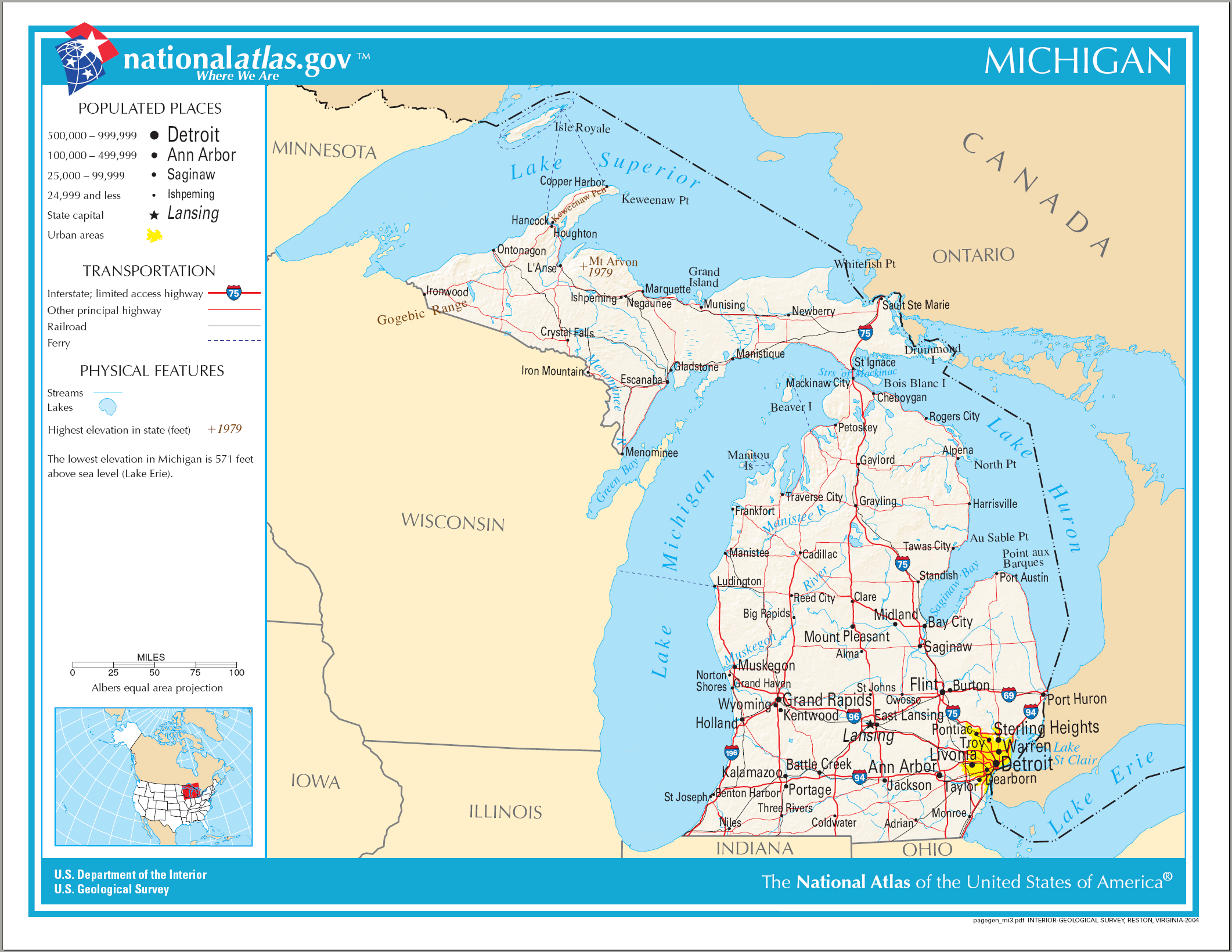
Datei:Map of Michigan NA.png
Größe dieser Vorschau: 776 × 600 Pixel. Weitere Auflösungen: 311 × 240 Pixel | 621 × 480 Pixel | 994 × 768 Pixel | 1.280 × 989 Pixel | 2.122 × 1.640 Pixel.
Originaldatei (2.122 × 1.640 Pixel, Dateigröße: 1,21 MB, MIME-Typ: image/png)
Beschreibung
| Beschreibung |
English: Map of Michigan |
| Datum | |
| Quelle | National Atlas |
| Urheber |
Lizenz
Diese Karte stammt aus einer Ausgabe des National Atlas of the United States. Wie fast alle Arbeiten der Regierung der Vereinigten Staaten sind Arbeiten des National Atlas in den USA gemeinfrei.
Online-Zugang: NationalAtlas.gov | Gedruckte Ausgabe von 1970: Library of Congress, Perry-Castañeda Library
|
Dateiversionen
Klicke auf einen Zeitpunkt, um diese Version zu laden.
| Version vom | Vorschaubild | Maße | Benutzer | Kommentar | |
|---|---|---|---|---|---|
| aktuell | 23:09, 14. Aug. 2006 | | 2.122 × 1.640 (1,21 MB) | wikimediacommons>Huebi~commonswiki | {{Information| |Description=Map of Michigan |Source=[http://www.nationalatlas.gov National Atlas] }} Category:Maps of the United States Category:Maps of Michigan {{PD-USGov-Atlas}} |
Dateiverwendung
Die folgende Seite verwendet diese Datei: