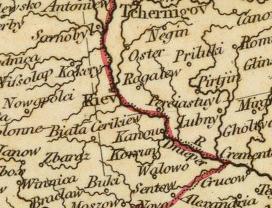
Datei:Kiev on 1804 map.jpg
Es ist keine höhere Auflösung vorhanden.
Kiev_on_1804_map.jpg (272 × 208 Pixel, Dateigröße: 21 KB, MIME-Typ: image/jpeg)
| Description |
|
|---|---|
| Source |
|
| Date |
c. 1804 |
| Author |
Cary, John, ca. 1754-1835 |
| Permission (Reusing this file) |
See below.
|
| This file is in the public domain because its copyright has expired in the United States and those countries with a copyright term of no more than the life of the author plus 100 years.
|
| The uploader or another editor requests that a local copy of this file be kept. This image or media file may be available on the Wikimedia Commons as File:Kiev on 1804 map.jpg. While the license of this file may be compliant with the Wikimedia Commons, an editor has requested that the local copy be kept too. This file does not meet CSD F8 and should not be tagged as a Commons duplicate. If you desire to nominate it for deletion, notify the tagging editor. |
Dateiversionen
Klicke auf einen Zeitpunkt, um diese Version zu laden.
| Version vom | Vorschaubild | Maße | Benutzer | Kommentar | |
|---|---|---|---|---|---|
| aktuell | 06:59, 27. Mai 2007 | | 272 × 208 (21 KB) | enwikipedia>Irpen |
Dateiverwendung
Die folgende Datei ist ein Duplikat dieser Datei (weitere Details):
- Datei:1804ம் ஆண்டு நில வரைபடத்தில் கீவ்.jpg aus Wikimedia Commons
Die folgende Seite verwendet diese Datei: