Datei:Indochina map 1886.jpg

Originaldatei (1.626 × 2.114 Pixel, Dateigröße: 533 KB, MIME-Typ: image/jpeg)
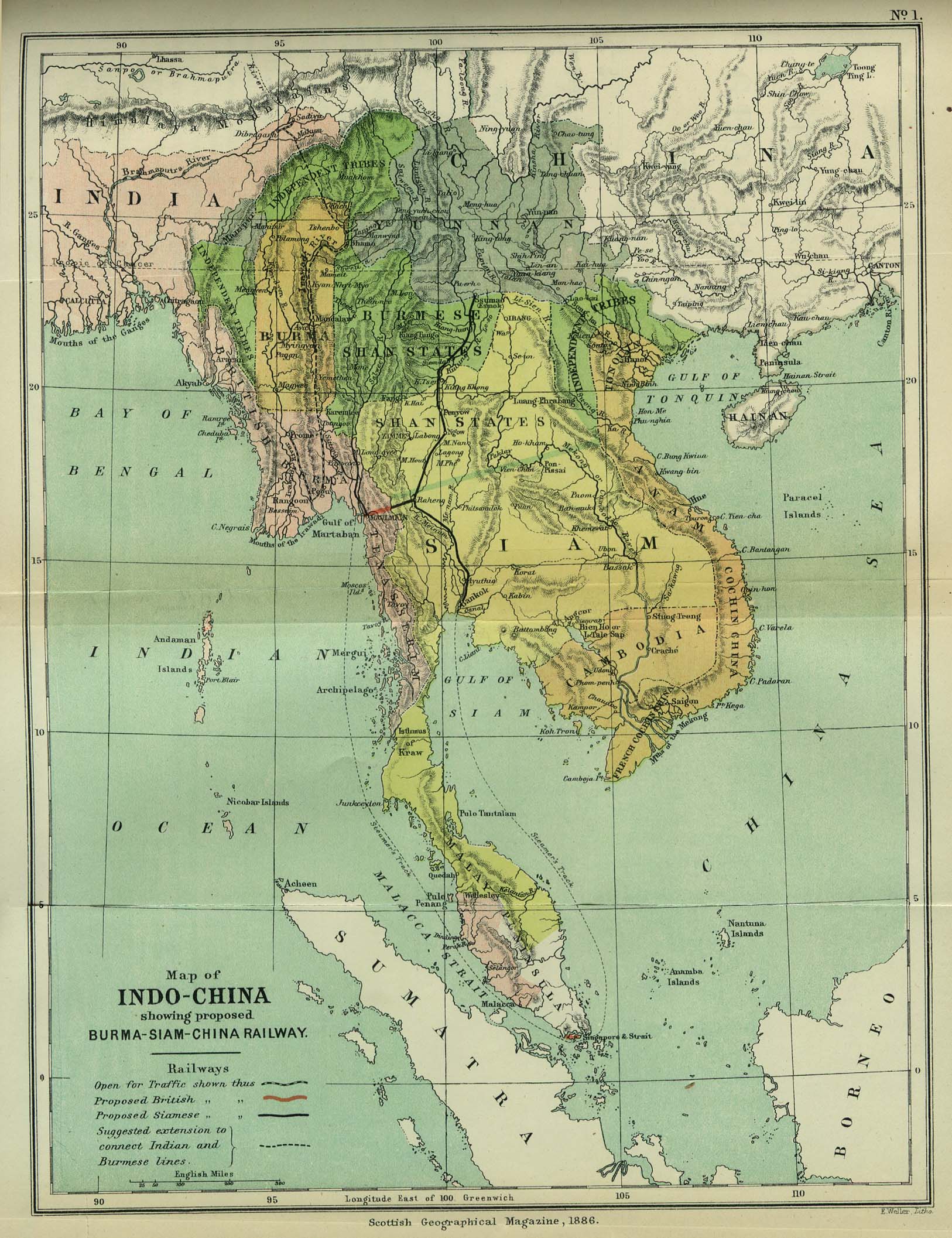
| Beschreibung | Map of Indochina | ||||
| Datum | |||||
| Quelle | http://www.lib.utexas.edu/maps/cambodia.html (http://www.lib.utexas.edu/maps/historical/indo_china_1886.jpg); Scottish Geographical Magazine (Volume II) | ||||
| Urheber | Scottish Geographical Magazine and edited by Hugh A. Webster and Arthur Silva White | ||||
| Genehmigung (Weiternutzung dieser Datei) |
|
||||
| Andere Versionen | File:IndoChina1886.jpg | ||||
Dateiversionen
Klicke auf einen Zeitpunkt, um diese Version zu laden.
| Version vom | Vorschaubild | Maße | Benutzer | Kommentar | |
|---|---|---|---|---|---|
| aktuell | 04:56, 2. Mai 2008 | | 1.626 × 2.114 (533 KB) | wikimediacommons>Calliopejen1 | {{Information |Description=Map of French Indochina |Source=http://www.lib.utexas.edu/maps/cambodia.html (http://www.lib.utexas.edu/maps/historical/indo_china_1886.jpg) |Date=1886 |Author=Scottish Geographical Magazine |Permission={{PD-old}} |other_version |
Dateiverwendung
Die folgende Seite verwendet diese Datei: