Datei:Field-Map birdie.jpg
Größe dieser Vorschau: 561 × 599 Pixel. Weitere Auflösungen: 225 × 240 Pixel | 449 × 480 Pixel | 719 × 768 Pixel | 959 × 1.024 Pixel | 1.918 × 2.048 Pixel | 2.592 × 2.768 Pixel.
Originaldatei (2.592 × 2.768 Pixel, Dateigröße: 2,76 MB, MIME-Typ: image/jpeg)
Beschreibung
| Beschreibung |
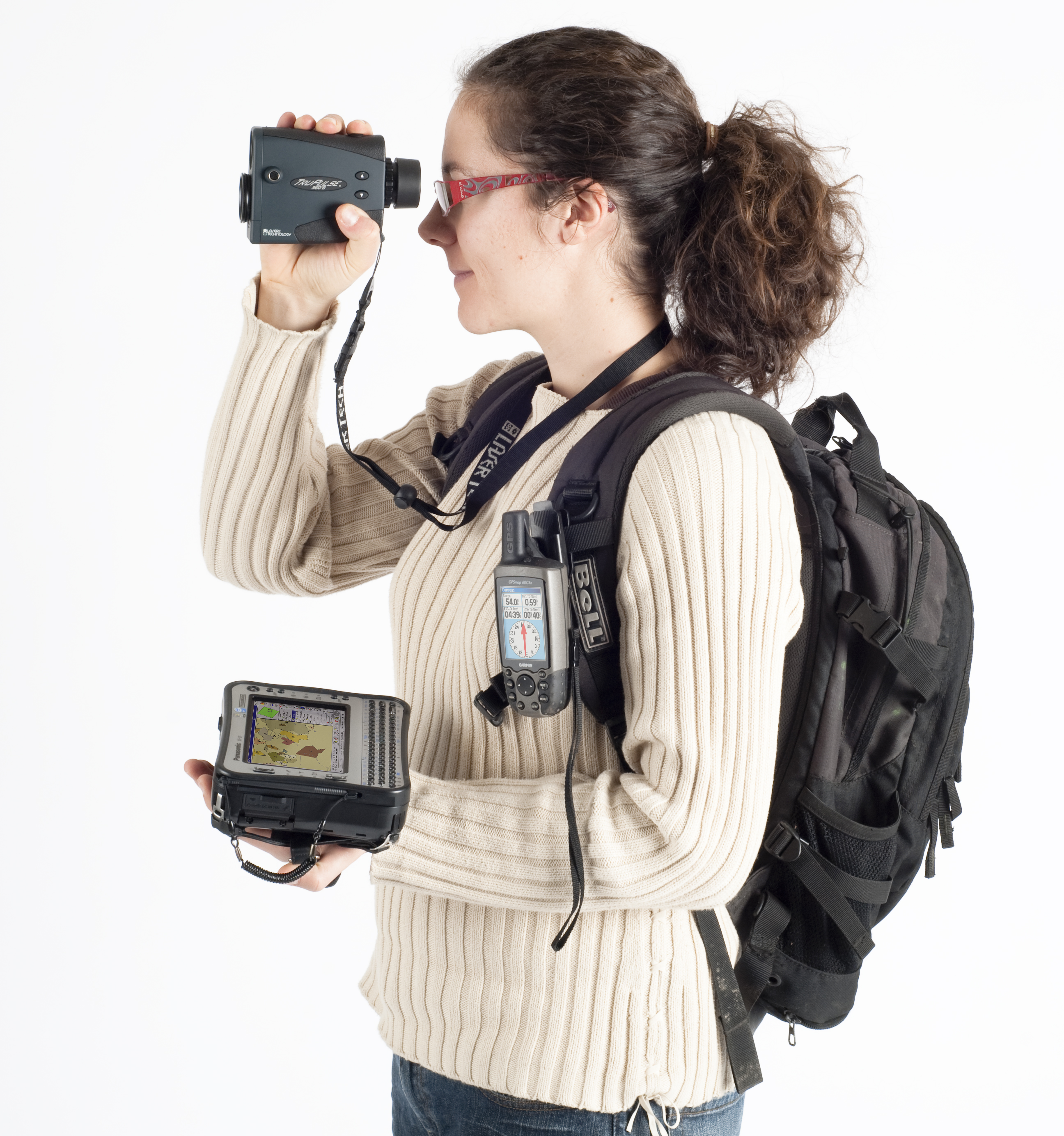
Français : Field-Map : Exemple de la technologie pour les inventaires forestiers (laser télémètre, inclinomètre, boussole électronique, GPS, ordinateur de terrain)
English: Field-Map : Example of hardware equipment for forest inventories: GPS and laser rangefinder for mapping connected to a field rugged computer. Čeština: Field-Map : Technologie pro inventarizace lesů a lesní taxaci (laserový dálkoměr, GPS, terénní počítač). |
| Datum | 3. 7. 2010 |
| Quelle | Eigenes Werk |
| Urheber | Claudiusmm |
Lizenz
| Ich, der Urheberrechtsinhaber dieses Werkes, veröffentliche es als gemeinfrei. Dies gilt weltweit. In manchen Staaten könnte dies rechtlich nicht möglich sein. Sofern dies der Fall ist: Ich gewähre jedem das bedingungslose Recht, dieses Werk für jedweden Zweck zu nutzen, es sei denn, Bedingungen sind gesetzlich erforderlich. |
Dateiversionen
Klicke auf einen Zeitpunkt, um diese Version zu laden.
| Version vom | Vorschaubild | Maße | Benutzer | Kommentar | |
|---|---|---|---|---|---|
| aktuell | 10:40, 3. Jul. 2010 | | 2.592 × 2.768 (2,76 MB) | wikimediacommons>Claudiusmm | {{Information |Description={{fr|1=Exemple de la technologie pour les inventaires forestiers (laser télémètre, in-clinomètre, boussole électronique, GPS, ordinateur de terrain) }} {{en|1=Hardware for forest inventories: laser range-finder, GPS, field- |
Dateiverwendung
Die folgende Seite verwendet diese Datei: