Datei:Eurozone.svg

Größe der PNG-Vorschau dieser SVG-Datei: 450 × 456 Pixel. Weitere Auflösungen: 237 × 240 Pixel | 474 × 480 Pixel | 758 × 768 Pixel | 1.011 × 1.024 Pixel | 2.021 × 2.048 Pixel.
Originaldatei (SVG-Datei, Basisgröße: 450 × 456 Pixel, Dateigröße: 417 KB)
Beschreibung
| Beschreibung |
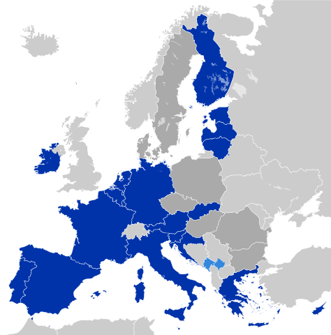
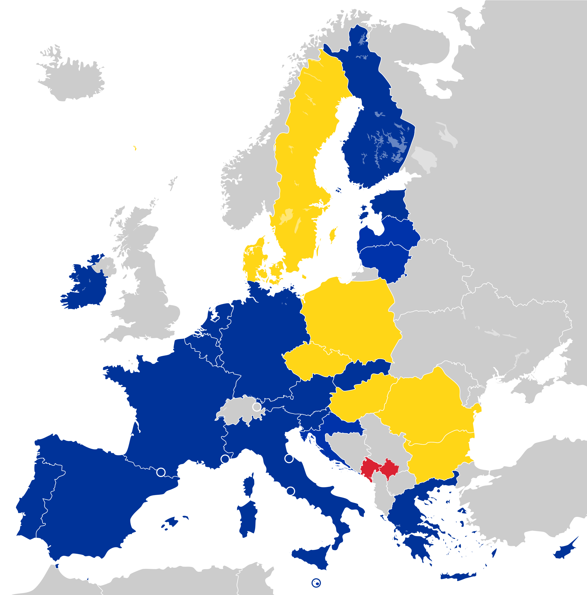
Deutsch: Eurozone
Staaten, die den Euro de jure angenommen haben Staaten und Gebiete, die den Euro de facto angenommen haben EU-Mitglieder außerhalb der Eurozone English: Eurozone
Countries using the Euro de jure Countries and territories using the Euro de facto EU member states that are outside the Eurozone Français : Zone euro
Pays ayant adopté l'euro de jure Pays et territoires utilisant l'euro de facto États membres de l'Union européenne n'ayant pas adopté l'euro Hrvatski: Eurozona
Članice Eurozone Države koje koriste Euro kao sredstvo plaćanja, ali su izvan Eurozone i Europske unije (Kosovo i Crna Gora) Članice Europske unije koje su izvan Eurozone Latviešu: Eirozona
Valstis, kuras izmanto eiro de jure Valstis un teritorijas, kuras izmanto eiro de facto Eiropas savienības dalībvalstis ārpus eirozonas Polski: Strefa Euro
Kraje używające Euro de jure Kraje i terytoria używające Euro de facto Członkowie Unii Europejskiej będący poza strefą Euro Português: Zona Euro
Países que adotaram de jure o euro Países e territórios que utilizam de facto o euro Estados-membros da União Europeia que não adotaram o euro Српски / srpski: Еврозона
Чланице еврозоне Државе и области, које користе Евро као средство плаћања, али су ван Еврозоне и Европске уније (Црна Гора и Косово) Чланице Европске уније, које су ван Еврозоне Українська: Єврозона
Країни, що використовують Євро де-юре Країни та території, що використовують Євро де-факто Країни-члени ЄС за межами єврозони فارسی: منطقه یورو
کشورهایی که یورو را به طور رسمی پذیرفتهاند کشورها و مناطقی که از یورو به عنوان وسیله پرداخت استفاده می کنند اما عضو منطقه یورو نیستند کشورهای عضو اتحادیه اروپا که خارج از منطقه یورو هستند |
| Datum | |
| Quelle | Europe countries.svg |
| Urheber | Glentamara |
| SVG‑Erstellung |
Lizenz
| Ich, der Urheberrechtsinhaber dieses Werkes, veröffentliche es als gemeinfrei. Dies gilt weltweit. In manchen Staaten könnte dies rechtlich nicht möglich sein. Sofern dies der Fall ist: Ich gewähre jedem das bedingungslose Recht, dieses Werk für jedweden Zweck zu nutzen, es sei denn, Bedingungen sind gesetzlich erforderlich. |
Dateiversionen
Klicke auf einen Zeitpunkt, um diese Version zu laden.
| Version vom | Vorschaubild | Maße | Benutzer | Kommentar | |
|---|---|---|---|---|---|
| aktuell | 07:47, 2. Mär. 2023 | | 450 × 456 (417 KB) | wikimediacommons>Discombobulates | Unify Cyrpus, recognised by the EU as one state |
Dateiverwendung
Die folgenden 3 Seiten verwenden diese Datei: