Datei:Chiaves-la-florida-1584.jpg
Größe dieser Vorschau: 800 × 544 Pixel. Weitere Auflösungen: 320 × 218 Pixel | 640 × 435 Pixel | 1.024 × 696 Pixel | 1.280 × 870 Pixel | 2.748 × 1.868 Pixel.
Originaldatei (2.748 × 1.868 Pixel, Dateigröße: 665 KB, MIME-Typ: image/jpeg)
Beschreibung
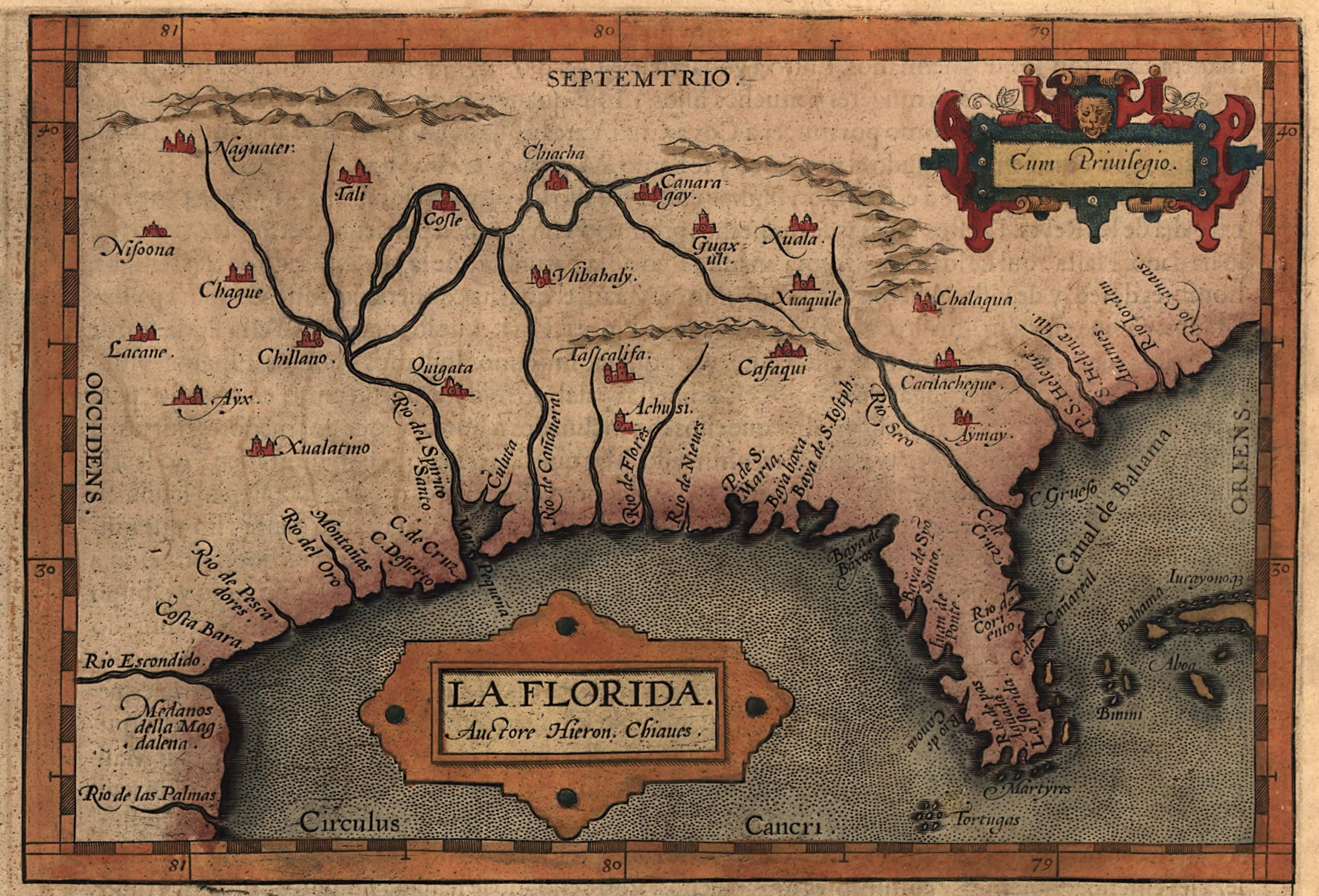
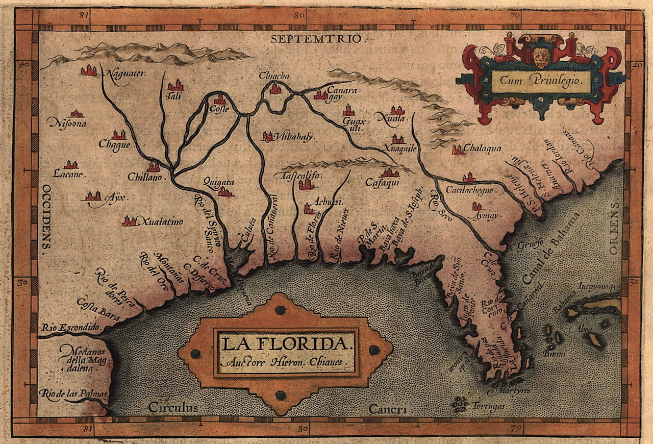
| Beschreibung | Map of the Spanish province of "La Florida," which included most of the southeastern United States. The map was drawn by Spanish royal cartographer Geronimo Chiaves, and was probably based on accounts by members of the Hernando De Soto expedition (1539-1543). The map was originally published in Abraham Ortelius' Theatrum Orbis Terrarum in 1584. |
| Datum | |
| Quelle | https://www.loc.gov/exhibits/earlyamericas/online/aftermath/aftermath2.html |
| Urheber | Geronimo Chiaves, Abraham Ortelius |
Lizenz
|
Dieses Werk ist gemeinfrei, weil seine urheberrechtliche Schutzfrist abgelaufen ist. | |
| Es wurde festgestellt, dass diese Datei frei von bekannten Beschränkungen durch das Urheberrecht ist, alle verbundenen und verwandten Rechte eingeschlossen. | |
Dateiversionen
Klicke auf einen Zeitpunkt, um diese Version zu laden.
| Version vom | Vorschaubild | Maße | Benutzer | Kommentar | |
|---|---|---|---|---|---|
| aktuell | 22:14, 24. Apr. 2008 | | 2.748 × 1.868 (665 KB) | wikimediacommons>BrineStans | {{Information |Description=Map of the Spanish province of "La Florida," which included most of the southeastern United States. The map was drawn by Spanish royal cartographer Geronimo Chiaves, and was probably based on accounts by members of the Hernando |
Dateiverwendung
Die folgende Seite verwendet diese Datei: