Datei:Oxford UK locator map.svg

Größe der PNG-Vorschau dieser SVG-Datei: 510 × 599 Pixel. Weitere Auflösungen: 204 × 240 Pixel | 408 × 480 Pixel | 653 × 768 Pixel | 871 × 1.024 Pixel | 1.742 × 2.048 Pixel | 1.077 × 1.266 Pixel.
Originaldatei (SVG-Datei, Basisgröße: 1.077 × 1.266 Pixel, Dateigröße: 921 KB)
| Beschreibung |
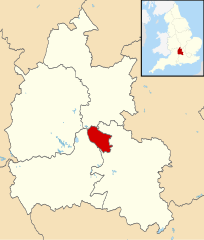
Map of Oxfordshire, UK with Oxford highlighted. Equirectangular map projection on WGS 84 datum, with N/S stretched 160% |
| Datum | |
| Quelle |
|
| Urheber | Nilfanion, created using Ordnance Survey data |
| Genehmigung (Weiternutzung dieser Datei) |
Diese Datei ist unter der Creative-Commons-Lizenz „Namensnennung – Weitergabe unter gleichen Bedingungen 3.0 nicht portiert“ lizenziert. Namensnennung: Contains Ordnance Survey data © Crown copyright and database right
|
Dateiversionen
Klicke auf einen Zeitpunkt, um diese Version zu laden.
| Version vom | Vorschaubild | Maße | Benutzer | Kommentar | |
|---|---|---|---|---|---|
| aktuell | 12:00, 2. Aug. 2011 | | 1.077 × 1.266 (921 KB) | wikimediacommons>Nilfanion | {{Information |Description=Map of Oxfordshire, UK with Oxford highlighted. Equirectangular map projection on WGS 84 datum, with N/S stretched 160% |Source=Ordnance Survey [https://www.ordnancesurvey.co |
Dateiverwendung
Die folgende Seite verwendet diese Datei: