Datei:NPS yellowstone-map-2020.jpg

Größe dieser Vorschau: 505 × 599 Pixel. Weitere Auflösungen: 202 × 240 Pixel | 405 × 480 Pixel | 647 × 768 Pixel | 863 × 1.024 Pixel | 1.727 × 2.048 Pixel | 3.000 × 3.558 Pixel.
Originaldatei (3.000 × 3.558 Pixel, Dateigröße: 2,5 MB, MIME-Typ: image/jpeg)
Beschreibung
Beschreibung
| Beschreibung |
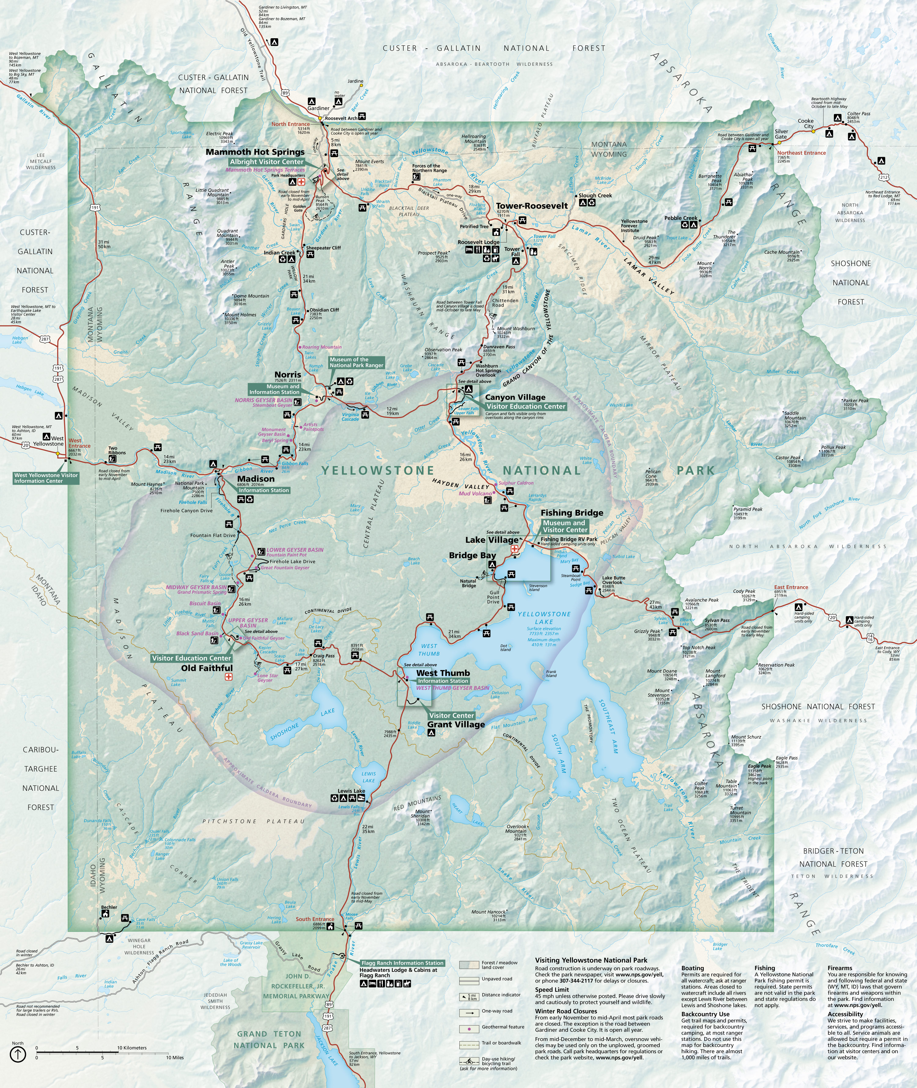
English: Main Yellowstone National Park map showing roads, attractions, lodging, and campgrounds throughout the entire park. |
| Datum | |
| Quelle | U.S. National Park Service (http://npmaps.com/wp-content/uploads/yellowstone-national-park-map.jpg) |
| Urheber | U.S. National Park Service, restoration/cleanup by Matt Holly |
Lizenz
| Diese Datei ist ein Werk eines Mitarbeiters des National Park Service (NPS) der Vereinigten Staaten, aufgenommen oder hergestellt während seiner offiziellen Anstellung. Als ein amtliches Werk der Bundesregierung der Vereinigten Staaten ist dieses Bild gemeinfrei. (Nähere Informationen dazu sind auf der offiziellen Website des NPS verfügbar.) |
Dateiversionen
Klicke auf einen Zeitpunkt, um diese Version zu laden.
| Version vom | Vorschaubild | Maße | Benutzer | Kommentar | |
|---|---|---|---|---|---|
| aktuell | 22:08, 15. Jul. 2022 | | 3.000 × 3.558 (2,5 MB) | wikimediacommons>Ductwork | =={{int:filedesc}}== {{Information |description= {{en|1=Main Yellowstone National Park map showing roads, attractions, lodging, and campgrounds throughout the entire park.}} |date= 2020-07-17 |source= U.S. National Park Service (http://npmaps.com/wp-content/uploads/yellowstone-national-park-map.jpg) |author= {{Creator:NPS/Matt Holly}} |permission= |other versions= }} =={{int:license-header}}== {{NPS Maps}} Category:Maps of Yellowstone National Park |
Dateiverwendung
Die folgende Seite verwendet diese Datei: